How do you read a tide chart for surfing? Look up the times of high and low tide for the day, then check which way the water is moving when you want to surf. On most sandy beach breaks, the best waves for beginners come on a rising tide around mid-tide, and in Tamarindo that usually means the two hours before high tide. The heights and the coefficient tell you how big that change is and how strong the currents will be.
The short version: a tide chart lists the highs and lows. Surf on the way up, not at the very bottom. A big difference between high and low (or a coefficient above 90) means more current; a small one means a gentler day. And because the tide comes about 50 minutes later each day, your perfect window moves too.
That really is most of it. The rest of this post explains each number, then works through a real Tamarindo day from our own Tamarindo tide chart so you can see how we would actually plan it.
What a Tide Chart Shows You
A tide chart is a list of turning points: the times when the water stops rising and starts falling, and the other way round. Each row is one day. For each high and each low you get two things:
- the time, in local time;
- the height, in meters or feet, measured from a fixed reference level (that is why a low tide can show 0.1 m, or even a negative number).
Some charts add sunrise and sunset, which matters more than you would think, and a coefficient, which we will get to in a minute.
Tamarindo, like most of Costa Rica’s Pacific coast, has two highs and two lows on most days, roughly six hours apart. The two highs are usually not the same height, so read both rather than assuming the morning and afternoon tides are twins.
Rising or Falling: The Part That Matters Most
For surfing, the direction of the tide matters more than the exact height. Between a low and the next high the tide is rising (incoming, or “pushing”). Between a high and the next low it is falling (outgoing, or “draining”).
On a sandy beach break, the tide changes how deep the water is over the sandbars, and the depth decides how the wave breaks:
- Too low: the water over the sandbars is shallow, waves stand up fast and close out all at once, and there is less water between you and the sand.
- Rising, around mid-tide: the sandbars still shape the wave, but there is enough water for it to break softly and peel. This is the window most beginners want.
- Right at the top of a big high: the waves can get fat and slow, or break right on the shore.
The tide also does not move at a steady speed. It moves slowly near the high and the low and fastest in the middle, so most of the change happens in the two middle hours of each six-hour swing. Surfers sometimes call this the rule of twelfths. In practice it means conditions can change quickly around mid-tide, and a session that starts perfect can be gone an hour later.
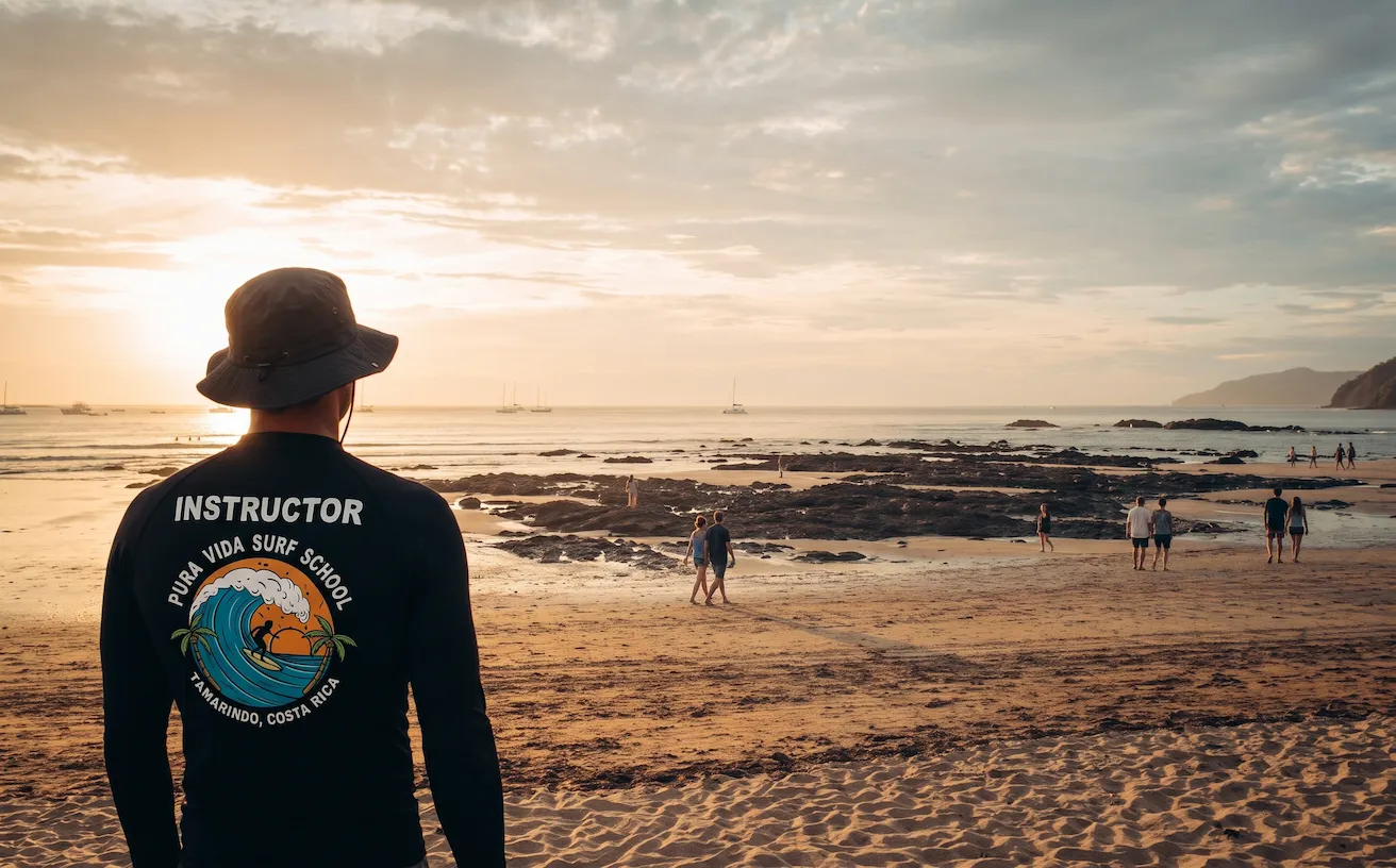
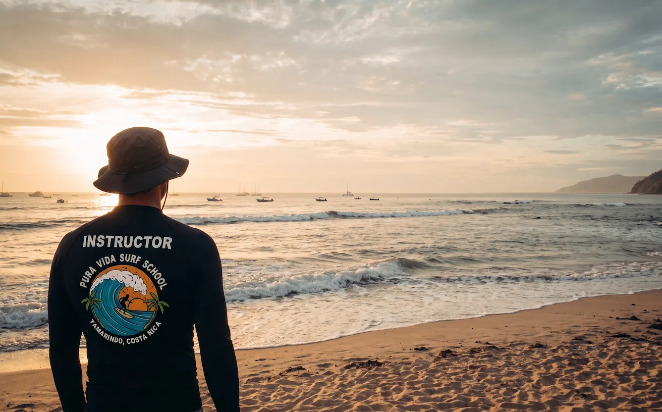
Those two photos are the same spot in Tamarindo a few hours apart. At low tide the rocks and the sandbars are out of the water. At high tide they are covered and the waves break much closer to the beach. Same ocean, completely different surf.
Tide Height and the Coefficient
The heights tell you how much the water moves between high and low, and that is what the coefficient sums up. Subtract the low from the high. A bigger number means more water moving in the same six hours, which means stronger currents and faster changes on the beach.
The coefficient puts that into one number, usually between about 20 and 120:
| Coefficient | What it means | How it feels in the water |
|---|---|---|
| Under 40 | Neap tide, small range | Gentle, slow changes; often the easiest days for a first lesson |
| 40 to 90 | Average day | Normal tidal currents; plan around the rising tide |
| 90 and above | Spring tide, big range | Strong currents and rips, fast changes; the timing matters a lot more |
Big coefficients come around new and full moon, small ones around the half moons. On our Tamarindo chart the coefficient is an estimate based on the moon phase, which is accurate enough for planning a session.
Reading a Real Tamarindo Day, Step by Step
Here is how we would plan around two real days from our tide chart in November 2026.
| Day | Coefficient | Tides | Sunrise / sunset |
|---|---|---|---|
| Thu, Nov 19 | 38 (low) | Low 3:25 am 0.9 m · High 9:27 am 1.9 m · Low 3:39 pm 0.8 m · High 10:09 pm 2.1 m | 5:41 am / 5:19 pm |
| Tue, Nov 24 | 101 (very high) | High 1:48 am 2.6 m · Low 8:13 am 0.3 m · High 2:20 pm 2.3 m · Low 8:19 pm 0.4 m | 5:43 am / 5:19 pm |
November 19. The high tide that matters is 9:27 am, because the 10:09 pm one is after dark. Count back two hours and you get 7:30 to 9:30 am, with the water rising the whole time. The range is only about 1 m (1.9 m high, 0.9 m low) and the coefficient is 38, so it is a gentle day. That is close to an ideal morning for a beginner, and the early hour usually comes with less wind too.
November 24. Now the coefficient is 101 and the water drops all the way to 0.3 m. The useful high is 2:20 pm, so the window is roughly 12:20 to 2:20 pm. It is still a rising tide, but about 2 m of water moves in six hours, so currents are stronger, rips are more likely and the beach changes fast. Experienced surfers might love it. For a first lesson we would keep everyone further inside and watch the clock closely.
Notice something else: on November 16 the morning high was at 6:46 am, and three days later it was at 9:27 am. Tides come about 40 to 60 minutes later every day, so the good window slides from early morning to late morning in less than a week. Never plan your whole trip from one day’s chart.
Tide Is Only One Piece
A perfect tide does not help if the swell is flat or the wind is blowing onshore. Tide charts predict the water level from the moon and the sun. They know nothing about waves or wind. The best sessions line up three things:
- A good tide for that particular beach.
- Swell, meaning waves coming in from storms far away, of a size that suits your level.
- Light or offshore wind, which in Guanacaste usually means mornings.
Every beach also has its own favorite tide. Tamarindo’s main break likes a rising mid-tide, while Playa Grande just to the north handles lower tides better, and reef breaks like Avellanas want different tides again. Our tide chart page lists the best tide for each local spot, and the best time to surf in Tamarindo covers the seasons and the wind.
Do Beginners Need to Read Tide Charts?
Not for your first lessons, but it is worth learning before you surf on your own. When you take a lesson with us, we pick the time and the part of the beach around the tide, so you can just show up. Once you start renting a board and going out by yourself, reading the chart is how you avoid paddling out at dead low tide into closeouts and strong currents. (It is also one of the easiest ways to look like you know what you are doing.)
If you are still at the start, how many surf lessons it takes to learn to surf explains when most people are ready to go out alone. Until then, book one of our surf lessons in Tamarindo and leave the tide math to us.
Let Us Pick the Tide
We schedule every lesson around the tide, so your 90 minutes land in the best window of the day. Board and rash guard included, and you stand up in your first lesson or your next one is free.